The Fire Clouds Over Volcanic Eruptions
How Pyrocumulonimbus Form and Impact the Atmosphere

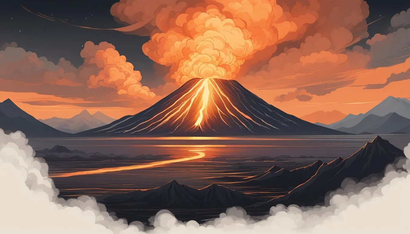
Fire clouds, or pyrocumulus clouds, form when intense heat from volcanic eruptions or wildfires causes rapid upward movement of air, leading to the development of tall, striking cloud formations. These dramatic clouds can reach significant heights and sometimes even produce lightning, posing additional hazards to areas already affected by volcanic activity.
Pyrocumulus clouds are not exclusive to wildfires; volcanic eruptions are powerful enough to drive their formation as massive amounts of ash, gas, and heat push into the atmosphere. Observing these clouds offers insight into the sheer force and complexity of volcanic events, highlighting how natural forces shape weather patterns above active volcanoes.
What Are “Fire Clouds” Over Volcanic Eruptions?
Fire clouds, also known as pyrocumulus or pyrocumulonimbus clouds, are dramatic weather phenomena triggered by intense heat sources like volcanic eruptions. These clouds play a significant role in atmospheric conditions and can impact local weather, air travel, and the distribution of volcanic ash.
Definition and Characteristics
A fire cloud forms when extreme heat rapidly lifts particles, water vapor, and gases into the atmosphere. Over volcanic eruptions, the intense thermal updraft carries ash, smoke, and moisture upward, causing a tall and often dark cloud to develop.
The base of these clouds typically appears close to the eruption site. They often have a towering, cauliflower shape and can extend many kilometers into the sky.
Key features include:
Fast vertical growth
Dense, dark appearance
Association with active heat sources such as volcanic lava
These clouds can also influence local weather, leading to unusual gusts of wind or rainfall near the eruption.
Key Terminology: Pyrocumulus and Pyrocumulonimbus
The term pyrocumulus refers to cumulus-type clouds formed from intense heat sources like wildfires or volcanic activity. The prefix “pyro” means fire, pointing to their fiery origins.
If the fire cloud grows larger and stronger, it may become a pyrocumulonimbus cloud. This is a thunderstorm-producing cloud, distinguished by its ability to generate lightning, rain, and sometimes hail within volcanic plumes.
Term Description Pyrocumulus Heat-generated cumulus cloud Pyrocumulonimbus Advanced stage, produces thunder & rain Cumulonimbus Thunderstorm cloud, not fire-based
Both types are structurally similar but differ in intensity, moisture content, and weather effects.
Differences from Other Cloud Types
Fire clouds differ from regular cumulus and cumulonimbus clouds in their origin. While typical cumulus clouds are driven by solar heating of the Earth's surface, pyrocumulus forms from the direct heat of volcanic eruptions or fires.
Cumulonimbus clouds, which cause common thunderstorms, build from moist, warm air rising under normal atmospheric conditions. In contrast, pyrocumulonimbus clouds arise from volatile conditions around a powerful heat source and may carry volcanic ash and debris into the stratosphere.
Unlike standard clouds, fire clouds frequently have a darker appearance from soot and ash. Their development can rapidly alter local weather and visibility, presenting unique hazards not seen in typical weather clouds.
How Fire Clouds Form During Volcanic Eruptions

Fire clouds, known scientifically as pyrocumulus or pyrocumulonimbus clouds, result from the unique combination of intense heat, ash, and moisture released during volcanic eruptions. These clouds can grow rapidly and reach towering heights under the right atmospheric conditions.
The Role of Heat and Updrafts
The extreme heat produced by a volcanic eruption is the primary force behind fire cloud formation. When magma and hot gases escape from a volcano, they rapidly heat the surrounding air.
This heated air becomes significantly less dense than the cooler air above. As a result, it rises quickly, creating strong updrafts that carry volcanic material skyward.
The strength of these updrafts often determines the height and extent of the resulting fire cloud. In some cases, the vertical motion is powerful enough to penetrate the upper troposphere, occasionally reaching the lower stratosphere.
Ash, Smoke Plumes, and Water Vapor
As the updrafts elevate hot air, they also lift vast quantities of volcanic ash and smoke into the atmosphere. Volcanic ash consists of fine particles of pulverized rock, minerals, and volcanic glass. These particles serve as condensation nuclei, which help water vapor in the air condense into droplets and form clouds.
Eruptions also release water vapor, either directly from volcanic gases or by vaporizing ice and snow around the volcano. The combination of ash, smoke plumes, and additional water vapor makes the clouds appear darker and more massive than typical cumulus clouds.
Table: Key Components Involved
Component Role in Fire Cloud Formation Ash Condensation nuclei and cloud darkening Smoke Plumes Carries heat, ash, and gases upward Water Vapor Cloud formation and growth
Atmospheric Conditions Required
Several atmospheric conditions must be met for fire clouds to form during volcanic eruptions. Sufficient moisture is necessary so water vapor can condense as the plume cools at higher altitudes.
Stability in the atmosphere plays a crucial role. If the atmosphere is unstable, the rising plume will continue to ascend and expand more easily. Wind speed and direction also influence the shape and dispersal of the cloud.
Low wind shear and high humidity tend to favor the development of larger, taller fire clouds. Conversely, strong wind shear may disrupt formation, spreading ash and vapor over a wider area without allowing vertical cloud growth.
Fire Cloud Weather Phenomena
Pyrocumulus and pyrocumulonimbus clouds that form above volcanic eruptions can create their own localized weather. These unique conditions often result in lightning, hail, and heavy rainfall that can drastically impact both the eruption site and surrounding regions.
Lightning and Thunderstorms Generated by Fire Clouds
Fire clouds over volcanic eruptions often generate intense lightning due to the rapid upward movement of ash, gases, and superheated air. As particles collide within the cloud, they build up electrical charges.
This charge separation leads to lightning strikes which are both frequent and powerful. Sometimes, the lightning can spark additional fires in surrounding areas if dry vegetation is present.
Thunderstorms can also develop within these clouds. The combination of moisture from the eruption, extreme heat, and turbulent updrafts gives rise to thunder and fast-moving storm systems. These storms are highly localized and may not be associated with broader weather patterns, making them difficult to predict.
Hail and Extreme Weather Events
The strong updrafts inside volcanic fire clouds can support the formation of hail. Supercooled water droplets freeze around ash or other particles, forming hailstones that eventually fall to the ground.
In some eruptions, hailstones have been observed miles away from the volcanic vent. The hail can range from small pellets to larger stones, depending on the strength of the updrafts.
Additional extreme weather events, such as tornado-force winds, have been reported near intense pyrocumulonimbus clouds. These winds are produced by sudden changes in air pressure and can create hazards for aviation and emergency response teams.
Rain Formation and Precipitation
Rain can develop in fire clouds when steam and water vapor from volcanic activity condense and combine with atmospheric moisture. This process is intensified by the vertical motion and cooling at higher altitudes within the cloud.
The result is often localized, intense rainfall near the eruption site. Heavy precipitation can quickly lead to dangerous conditions, such as mudflows (lahars) when rain mixes with loose volcanic ash on the ground.
These bursts of rain may aid in suppressing fires caused by lightning, but they can also exacerbate flooding and create hazardous travel and response conditions in the affected region.
Fire Clouds and Volcanic Hazards
Fire clouds—technically known as flammagenitus or pyrocumulonimbus—form when intense heat rapidly lifts air, carrying ash, smoke, and gases high into the atmosphere. These clouds can contribute to hazardous conditions both during wildfires and volcanic eruptions, creating new challenges for emergency response and public safety.
Wildfires and Fire Behavior
Wildfires often create their own weather systems through the generation of fire clouds. As vegetation burns, the heat forces air upwards, producing updrafts strong enough to lift smoke and ash several kilometers into the sky.
Key characteristics:
Rapid vertical transport of heat and particles
Cloud tops sometimes reach the lower stratosphere
Ash, smoke, and aerosols can spread for hundreds of kilometers
The presence of flammagenitus clouds can worsen local fire conditions. These clouds increase wind speeds and change wind directions, potentially making fire behavior less predictable. Ember attacks, where burning debris is carried far ahead of the fire front, become more common under fire cloud activity, raising the risk of new fires igniting beyond the main burn area.
Extreme Fire Behavior and Fire Tornadoes
Under certain conditions, fire clouds give rise to extreme fire behavior, including the development of fire tornadoes. These vortices form when intense heat and turbulent winds interact within the fire cloud’s updraft, creating spinning columns of fire and debris.
Notable hazards:
Fire tornadoes can reach hundreds of meters in height
Winds inside can exceed 160 km/h (100 mph)
Capable of uprooting trees and damaging structures
Beyond tornadoes, fire clouds can trigger lightning, causing additional ignition points during fire season. Volcanic eruptions that generate fire clouds exhibit similar risks, as volcanic heat interacts with combustible materials, further complicating efforts to control or predict fire movement. This increases the complexity for firefighters, scientists, and affected communities during both wildfire and volcanic events.
Scientific Studies and Monitoring Fire Clouds
Monitoring fire clouds over volcanic eruptions relies on sophisticated observation tools and the collaboration of major scientific organizations. Detection systems collect data on cloud formation and intensity, while agencies analyze this data to assess impacts and risks.
Detection Systems and Observation Technology
Remote sensing plays a central role in identifying and tracking fire clouds, especially those caused by volcanic eruptions. Geostationary and polar-orbiting satellites such as GOES-17 deliver continuous imaging, helping scientists monitor the development and movement of pyrocumulonimbus and pyrocumulus clouds.
Advanced sensors track variables including temperature, smoke concentration, water vapor, and cloud top height. Infrared and visible-light instruments can quickly detect and map fire cloud formation in real time. Detection systems also utilize ground-based radar and weather balloons to gather more detailed atmospheric data.
These methods allow for near-immediate detection of new fire clouds and provide crucial information for weather forecasting, public safety, and research.
Contributions of NASA and the U.S. Naval Research Laboratory
NASA supports fire cloud research through satellite programs like Terra, Aqua, and the Suomi NPP satellite. These missions supply high-resolution imagery and atmospheric measurements that capture the lifecycle of clouds above volcanoes. NASA scientists analyze satellite data to understand particle composition, cloud growth, and potential weather impacts.
The U.S. Naval Research Laboratory (NRL) contributes by developing algorithms and software to process satellite and radar data. The NRL’s atmospheric models help predict how fire clouds evolve and interact with the surrounding environment. Both organizations work jointly with other international agencies, sharing data and advancing scientific knowledge of fire cloud behavior and associated hazards.
Impacts on Climate and Environment
Fire clouds generated during volcanic eruptions contribute to significant changes in atmospheric conditions. Their effects extend from immediate changes in air composition to longer-lasting impacts on global climate systems.
Influence on Climate Change
Fire clouds, also known as pyrocumulonimbus clouds, inject large amounts of ash, gases, and particulates into the upper layers of the atmosphere.
These clouds can transport sulfur dioxide and carbon dioxide, which are released during volcanic eruptions, high into the stratosphere. Once there, these gases can influence climate in two main ways:
Sulfur dioxide converts into sulfate aerosols that reflect sunlight, causing temporary global cooling.
Carbon dioxide acts as a greenhouse gas, contributing to longer-term warming.
The scale of climate impact depends on eruption size and the amount of material released. Large eruptions have led to documented temperature drops in the following years due to aerosol shading.
Long-Term Atmospheric Effects
Long after an eruption, fire clouds affect atmospheric chemistry and composition. For example, ash and aerosols can remain suspended for months, altering cloud formation and precipitation patterns.
Persistent aerosols in the upper atmosphere reduce the amount of solar radiation reaching Earth's surface. This can disrupt photosynthesis in some regions and reduce surface temperatures for an extended period.
Additionally, volcanic fire clouds may damage the ozone layer by providing surfaces for chemical reactions that break down ozone molecules. These combined effects shape both weather patterns and large-scale atmospheric circulation over time.
Notable Historical Events Involving Fire Clouds
Several major volcanic eruptions have produced distinct fire clouds, some closely resembling the mushroom clouds seen in nuclear detonations. These events highlight not only the immense power of volcanic activity but also key similarities and differences with man-made explosions.
Major Volcanic Eruptions and Fire Cloud Events
Large volcanic eruptions can generate towering ash and steam clouds known as eruption columns or "fire clouds." For example:
Mount St. Helens (1980): Produced a massive vertical ash column, reaching 24 km (15 miles) into the atmosphere.
Mount Pinatubo (1991): Released ash and gas clouds that impacted global temperatures and formed persistent stratospheric clouds.
Krakatoa (1883): The eruption created a fire cloud visible for hundreds of kilometers, with effects felt globally.
These fire clouds often contain lightning, or “dirty thunderclouds,” due to the intense energy and ash content. Pyrocumulus clouds form when the eruption heats the atmosphere, rapidly building tall, dense clouds. Satellite data and eyewitness accounts confirm that these features are a hallmark of major explosive eruptions.
Comparison with Mushroom Clouds and Bomb Detonations
The shape and behavior of volcanic fire clouds often lead to comparisons with mushroom clouds from nuclear or large-scale bomb detonations. Both result from sudden, intense releases of heat and pressure.
A key difference lies in composition. Volcanic fire clouds carry ash, volcanic gases, and water vapor, while bomb mushroom clouds can contain radioactive material and combustion byproducts. Their visual similarity has led to confusion, especially in historic eruptions photographed before nuclear testing was widely known.
Both types of cloud can produce unique weather patterns, including artificial thunderclouds and localized wind phenomena. Scientists monitor these events to study atmospheric impacts and for hazard assessment. The recognition of fire clouds as natural analogs to bomb mushroom clouds has improved understanding of plume dynamics in both natural and artificial explosions.
Conclusion
Fire clouds, also known as pyrocumulonimbus clouds, frequently form above volcanic eruptions when intense heat pushes ash, moisture, and gases into the atmosphere.
These clouds can create their own weather, including lightning and strong winds, which sometimes increase the hazards during eruptions. Volcanic fire clouds differ from those formed above wildfires, but both share the characteristic of intense updrafts.
Key Features of Volcanic Fire Clouds:
Feature Description Formation Trigger Intense volcanic heat and eruption columns Common Weather Events Lightning, high winds, rapid cloud development Impacts Ash dispersal, increased fire risk, flight hazards
Fire clouds over volcanoes can rapidly change local conditions.
Researchers and emergency services monitor these clouds to track ash spread and assess potential risks for nearby communities and aviation. Continuous observation helps them react quickly as situations evolve.