Thermal Drones: Scanning for Apparitions Over Large Haunted Sites Using Advanced Infrared Technology
Thermal drones are becoming a common tool for investigating large haunted locations where conventional methods fall short. By utilizing thermal imaging technology from above, these drones can quickly cover wide areas and detect unusual heat signatures that might be missed on the ground. This approach allows investigators to scan everything from abandoned hospitals to remote fields, searching for temperature anomalies that could indicate possible apparitions or unexplained activity.
Recent cases show teams deploying drones equipped with thermal cameras to spot massive heat signatures or cold spots, sparking further investigation. The ability to monitor vast and difficult-to-access spaces gives researchers more comprehensive data and a new perspective on alleged hauntings.
Interest in combining drone technology with ghost hunting has risen as it offers a practical way to document and analyze thermal anomalies. The mix of advanced surveillance and paranormal research is changing how large haunted sites are explored.
The Role of Thermal Drones in Paranormal Investigations

Thermal drones have introduced new strategies for exploring haunted sites, enabling researchers to scan wide areas efficiently and securely. These tools help investigators distinguish natural heat sources from potential anomalies, improving data quality at large, complex locations.
Evolution of Drone Technology
Drones have advanced from simple remote-controlled aircraft to sophisticated platforms capable of supporting multiple sensors, including thermal cameras.
Today’s drones can remain airborne for extended periods and operate in challenging environments. This has been particularly valuable in regions like New York, Massachusetts, and New Jersey, where urban or rural landscapes may inhibit ground access.
Key advancements:
Autonomous flight patterns
GPS integration for precise mapping
Payload flexibility (thermal, infrared, visible cameras)
These improvements allow teams to cover large haunted properties or historical sites with minimal physical intrusion.
Understanding Thermal Imaging Capabilities
Thermal imaging cameras detect infrared radiation emitted by all objects based on their temperature. Drones equipped with these sensors can visualize heat signatures that are invisible to the naked eye.
Paranormal investigators use thermal imaging to identify sudden temperature drops or unexplained heat sources linked to reported ghost sightings. In practice, investigators in Georgia and New Hampshire report that thermal drones quickly differentiate between environmental factors—like animals or machinery—and less conventional thermal anomalies.
By mapping heat in real time, drones help rule out easily explainable phenomena, narrowing down areas that might require closer investigation.
Benefits Over Traditional Methods
Traditional ghost hunting relies on static cameras and handheld equipment, which often limit researchers to small zones and can miss fleeting activity.
Thermal drones allow for rapid, consistent coverage of extensive sites, such as abandoned mansions or cemeteries. Operators can survey rooftops, outbuildings, and wooded boundaries without entering potentially hazardous spaces.
Advantages include:
Greater safety—reducing the need to enter unstable or decayed structures
Higher efficiency—scanning entire properties in much less time
Objective data collection—capturing thermal patterns that support or refute eyewitness accounts
By integrating these technologies, teams in various states can approach investigations with better tools and clearer evidence, moving beyond speculation to a more structured approach.
Selecting the Best Thermal Drones for Haunted Sites

Choosing the right thermal drone can improve the accuracy of temperature readings and movement detection in large, suspected haunted locations. Important considerations include sensor quality, endurance, and compliance with local laws.
Key Features to Consider
Thermal sensor resolution is critical. A higher resolution sensor provides sharper images, which can help distinguish between natural wildlife population and unusual temperature readings that might be mistaken for apparitions.
Flight endurance and battery life impact how effectively a drone can cover expansive sites. Drones with a flight time of 30 minutes or more are preferred for scanning larger properties. Wind resistance also matters, especially for outdoor, rural, or exposed haunted locations.
IP ratings for water and dust resistance ensure the drone can operate in abandoned or deteriorating environments. Drones with at least IP54 or IP55 ratings are better suited for this nature of fieldwork. A dual payload setup—thermal and visual cameras—is helpful, as it allows operators to compare live thermal looks with standard footage.
Popular Drone Models
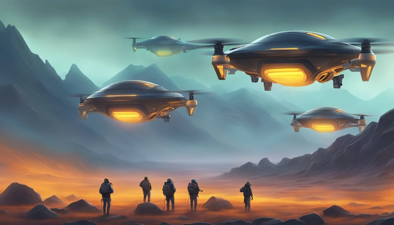
The DJI Mavic 3T Enterprise is frequently used due to its 48MP optical camera, integrated thermal sensor, and stable flight characteristics. It supports simultaneous thermal and visual imaging, extending its usefulness in complex investigations.
Parrot Anafi USA offers a lightweight frame and a 32x zoom, making it suitable for detailed inspection of building exteriors or tree lines. The Autel EVO II Dual 640T features a radiometric thermal camera with a 640x512 sensor, providing high-precision temperature readings over large sites.
The following table compares standout features:
Drone Model Thermal Resolution Flight Time IP Rating Dual Payload Support DJI Mavic 3T Enterprise 640x512 45 min IP54 Yes Parrot Anafi USA 320x256 32 min IP53 Yes Autel EVO II Dual 640T 640x512 38 min N/A Yes
Safety and Regulatory Guidelines
Operators must comply with aviation regulations. Most countries require registration for drones above a certain weight and may restrict flights near populated areas or protected nature sites.
It's important to maintain line-of-sight with the drone and avoid flying over active population centers at night without proper permissions. Using drones in heritage or abandoned sites may require special permits, especially if the property is listed or has conservation restrictions.
Check local laws for data storage and privacy requirements. Some regions have strict rules regarding thermal imaging over residential or private land. Always assess the support for failsafe features, such as return-to-home and obstacle avoidance, to enhance safety during ghost-hunting missions.
Operational Strategies for Large-Scale Scanning
Precise strategies are essential for thermal drone operations over haunted sites, as large and complex terrain can challenge both efficiency and data quality. Combining advanced mapping, equipment optimization, and environmental considerations increases the reliability of detecting unusual thermal signatures.
Mapping and Navigation Techniques
Large-scale haunted sites often feature irregular layouts, structures in disrepair, and unpredictable obstacles. Accurate mapping begins with high-resolution topographical data and established GPS waypoints.
Integrating GIS mapping software enables the drone to follow efficient flight paths and avoid hazards. Pilots typically use overlapping grid patterns to ensure no area is missed, while real-time telemetry feeds allow for mid-flight route adjustments as new hot spots are detected.
Night operations require attention to the twilight arch, when temperature differences between the ground and the atmosphere are most detectable. Flight planning must account for changing light conditions and the presence of dew or fog, especially near dawn or dusk.
Optimizing Thermal Sensor Performance
Thermal sensors are calibrated ahead of the flight to distinguish between environmental heat sources and potential apparitional activity. Pre-flight environmental data—such as ground moisture, air temperature, and heat retention in masonry—are logged to create accurate baseline readings.
A key setting is dynamic range adjustment to maximize sensitivity during cooler periods, usually just after sunset or near the peak of the nlc display.
Operators may run periodic sensor tests mid-flight, especially if flights pass near infrastructure, to correct for heat interference. Positioning the sensor on the edge of cooler regions, such as above treetops or rooflines, helps avoid false positives.
Efficiency During NLC Display and NLC Season
During the nlc season, the mesosphere hosts noctilucent clouds (NLCs), which can subtly influence thermal readings. Scanning during an nlc display—typically observed about 1–2 hours after sunset—may require adjusting drone routes or pausing flights if reflections or cold patches are detected in the sensor feed.
Pilots establish launch pads at strategic points to extend battery life and minimize downtime. Monitoring atmospheric data ensures that mesosphere variations don’t mislead operators, especially when scanning “on the edge” of haunted structures.
Technical crews maintain a log of each scan during NLC season, comparing past readings to identify patterns that correspond with the presence or absence of NLCs, optimizing for both speed and data integrity.
Uncovering Ghostly Phenomena Through Thermal Imaging
Thermal imaging with drones offers a direct way to investigate claims of ghosts and unexplained behavior in large, reportedly haunted sites. Instead of relying solely on traditional eye-witness accounts, teams now use temperature data to look for irregularities that cannot be explained by normal environmental changes.
Identifying Apparitions and Anomalies
Thermal drones allow investigators to scan wide areas, capturing images that show temperature variations invisible to the naked eye. When investigating reports of ghosts, such as shadowy figures or sudden drops in temperature, these drones play a key role in mapping and pinpointing the location of unusual anomalies.
In several documented cases, thermal cameras have caught unexplained heat signatures moving through abandoned hallways or hovering in rooms, sometimes described as potential apparitions. The ability to document such phenomena in real time—with footage that can be reviewed and shared—adds a layer of objectivity to the investigation of haunted locations.
It should be noted that temperature anomalies are not always evidence of ghosts or psychic energy; environmental factors, animals, or faulty insulation can produce similar readings. Teams often cross-reference each thermal image with environmental data to rule out mundane explanations before considering paranormal causes.
Corroborating Evidence With Other Methods
Thermal imaging is most effective when paired with other investigative techniques. Teams use EMF (electromagnetic field) meters, audio recorders, and visual surveillance to gather a comprehensive set of data. This multi-method approach helps distinguish genuine anomalies from technical errors or natural sources.
When a drone detects a cold spot or a moving heat signature, investigators often revisit the area to gather direct audio or visual evidence. For example, EMF spikes or recorded voices—possibly linked to reported psychic events—are logged alongside thermal data for a more complete investigation.
By cross-referencing the findings across multiple methods, teams can filter out false positives. The combined evidence from thermal drones, traditional ghost-hunting equipment, and environmental sensors provides a more reliable foundation for interpreting reports of apparitions, fairies, or unexplained magic in a given site.
Case Studies: Haunted Locations Surveyed by Thermal Drones
Thermal drones have been deployed to document unusual temperature patterns and detect anomalies across a range of reportedly haunted environments. Their infrared imaging capabilities allow for coverage of expansive areas and hard-to-access structures.
Famous Investigations in the United States
Investigators in the United States have used thermal drones to survey sites in states such as Massachusetts, New York, and Georgia. These locations are often associated with longstanding claims of hauntings and unexplained phenomena.
For example, in Massachusetts, thermal drones have been flown over historic cemeteries and Colonial-era buildings. The technology allowed detection of cold spots and sudden shifts in temperature gradients, which some interpret as potential evidence of paranormal activity.
New York teams have used drones to scan abandoned asylums on the outskirts of the city. Thermal imaging not only mapped the interior for safety but also revealed sharp anomalies in empty rooms, raising new questions for both researchers and the audience following the investigations.
In Georgia, plantation estates were mapped from the air. Infrared reconnaissance identified pattern shifts near locations rumored to be apparition hotspots. All imagery and data are typically reviewed with both technical experts and local historians to rule out environmental causes.
The House: A Notable Example
One widely discussed case involved the use of a thermal drone survey at a derelict residence simply referred to as “the house.” The operation was conducted over multiple nights to establish baseline temperature readings and monitor changes over time.
The drone’s high-resolution thermal camera captured distinct cold regions that persisted independent of outdoor weather. Sensors also noted brief flashes of heat along previously sealed corridors. All data were precisely logged and cross-referenced with previous eyewitness reports, allowing for systematic analysis.
Reviewers emphasize the controlled conditions and strict documentation used in this investigation. While the findings stopped short of confirming apparitions, the methodology demonstrated how drone technology can supplement traditional paranormal research with objective measurements.
Exploring Remote Settings Like Lough Fea
Remote settings such as the landscape surrounding Lough Fea offer unique challenges for thermal drone operators. Limited ground access and harsh terrain make aerial surveys the most effective approach.
Teams deployed drones equipped with thermal and high-zoom optical cameras to scan the wooded perimeters and water’s edge. The equipment registered isolated cold spots in patterns not consistent with natural environmental factors, prompting further ground checks.
This approach provides comprehensive thermal mapping while keeping personnel safe. All flight data are catalogued and presented to both academic and paranormal research audiences, facilitating peer review and public scrutiny. Findings from these surveys contribute to an expanding database of regional anomalies that could guide future investigations.
Challenges and Limitations of Thermal Drone Scanning

Thermal drones face significant technical and practical difficulties when scanning large haunted locations. Environmental conditions and data interpretation issues can impact results and require careful attention.
Environmental and Weather Factors
Thermal imaging relies on detecting infrared radiation, making it highly susceptible to environmental influences. Temperature fluctuations, humidity, and rainfall can distort thermal signatures. For instance, wet surfaces or reflective materials may obscure potential detections or introduce visual artifacts.
Dense vegetation, thick fog, or heavy wind cause inconvenience and may force operators to suspend flights. These factors can also lead to boredom and impatience among teams waiting for optimal scanning conditions. Additionally, unpredictable nighttime temperatures often require repeated scans to verify results, which can be resource-intensive during a crisis or a limited search window.
Operators must plan missions to avoid excessive heat from the sun, which can trigger false readings. Scheduling around sunrise or sunset typically offers the best results. Consistent pre-flight weather assessments and real-time adjustments are essential to reduce wasted time and minimize missed detections.
Potential for False Positives
Thermal drone scans can yield misleading or ambiguous images that mimic the shapes or heat signatures often attributed to apparitions. Animals, mechanical equipment, and even power outlets may register as unexplained heat sources.
Interpreting these anomalies requires patience and expertise to avoid jumping to conclusions. Without clear protocols, teams can face inconvenience and even embarrassment from reporting false positives. A table of common heat signatures and their likely sources is often used to support accurate analysis:
Heat Source Likely Explanation Small, moving hotspots Rodents, insects Stationary warm objects Electrical outlets Irregular ground patches Sun-warmed surfaces
The risk of misidentification, especially in a crisis requiring rapid results, underlines the need for corroborating data—such as visual video or EMF readings—to support any unusual thermal detection. Repeated occurrences of false positives may affect morale and patience, highlighting the need for experienced interpretation.
Enhancing Paranormal Documentation With Technology
Modern technology has changed how investigators record and analyze evidence at haunted sites. Drones and specialized equipment produce data that can be saved, compared, and reviewed over time.
Photography and Video Integration
Thermal drones are equipped with high-resolution cameras that capture both standard and thermal images. This technology helps investigators document temperature anomalies and visual cues simultaneously. Side-by-side thermal and visual footage allows for direct comparison, making it easier to rule out common causes like animals or reflections.
Video footage from aerial drones also offers broader site coverage than ground-based teams. Investigators can review footage frame by frame and catalog events with greater accuracy. Data logs, timestamps, and sensor readouts add context to every video, increasing reliability.
Photography is important for documenting unexplained events captured on thermal imaging. It provides a visual benchmark for environmental and temperature changes. A comparison table, such as the one below, can summarize key details for analysis:
Image Type Use Case Benefits Thermal Photo Detect cold spots Identifies anomalies Standard Photo Baseline reference Confirms environment
Using Illustrations for Visual Records
Illustrations offer another method for recording scenes and events outside the range of cameras. Investigators sometimes sketch floor plans or mark the location of temperature shifts and unexplained sounds. These hand-drawn visuals complement digital data by providing spatial awareness and context.
Detailed illustrations can document exact positions of unusual readings, such as where a trumpet sound was detected or where electronic equipment registered high EMF activity. This method is especially useful in areas with limited visibility or where technology cannot access certain spaces.
Including simple musical notations can help reconstruct sounds like music heard during investigations. Visual cues from illustrations, paired with other evidence, create a clearer overall picture of phenomena that may escape photographic documentation.
Astronomical Phenomena Affecting Thermal Drone Operations

Thermal drone effectiveness can be influenced by upper-atmosphere events that change background temperatures or disrupt electromagnetic stability. Certain astronomical phenomena present both predictable and variable challenges for operators monitoring haunted sites at night.
Aurora Borealis and Solar Maximum
The aurora borealis, triggered by the interaction of solar wind with Earth's magnetic field, creates sporadic emissions of light in the upper atmosphere. During periods of solar maximum, auroral activity intensifies due to increased solar wind and heightened geomagnetic disturbances.
These events can impact thermal drone operations in two main ways:
Thermal Imaging: Auroras mainly occur in the thermosphere and rarely affect ground temperatures. However, their energy input can cause transient heating in the upper atmosphere, which may slightly alter atmospheric background thermal signatures picked up by drones.
Electronic Interference: Electromagnetic fluctuations during strong auroral displays can sometimes disrupt drone electronics, sensors, or GPS accuracy, especially at latitudes closest to auroral ovals.
Operators should check geomagnetic activity forecasts and be cautious of potential technical difficulties during major solar events.
Noctilucent Clouds and the Mesosphere
Noctilucent clouds (NLCs) are thin clouds that form in the mesosphere at altitudes around 76–85 kilometers, most visible during the NLC season in late spring and early summer at high latitudes. These clouds reflect sunlight well after sunset, producing a faint, silvery glow in twilight skies.
Because NLCs are colder than any other clouds, their presence indicates extremely low mesospheric temperatures. Although NLCs themselves are too high to directly affect ground-level thermal drone scans, their visibility conditions coincide with rapid changes in near-ground thermal gradients overnight.
Key details about NLC influence:
Lighting: The unique illumination can subtly alter visual and infrared contrast near dusk and dawn, occasionally impacting the detection of temperature anomalies.
Seasonal Considerations: Operators conducting thermal scans during NLC season should account for changing twilight lighting and temperature transitions, especially when investigating outdoor haunted environments at northern latitudes.
Community Engagement and Future Prospects

Thermal drones are driving new levels of participation from enthusiasts and researchers alike. These technologies help connect audiences with investigations and support continuous innovation in paranormal detection.
Mobilizing the Paranormal Audience
Enthusiasts across cities like New York have shown increased interest in drone-assisted ghost hunts. Community events often draw crowds, especially when timed with local traditions or special dates like a haunted site’s birthday, encouraging active participation.
Groups frequently share thermal imagery on social platforms, making findings accessible and fostering discussion. Outreach initiatives have also included live-streamed drone flights, allowing viewers such as Ella or other supporters to witness scans in real time regardless of location.
This growing audience enables direct feedback, helping teams refine their methods and understand public expectations. Interactive experiences and transparent results have expanded the base of support for these ongoing efforts.
Expanding Research Frontiers
Researchers are using thermal drones to systematically map temperature anomalies over expansive haunted locations. These drones help catalog environmental data, allowing more thorough and structured investigations than manual surveys or stationary cameras.
In urban environments like New York, large sites that once seemed unmanageable—such as decommissioned hospitals or forgotten subway tunnels—are now more accessible. Historical societies and academic teams are collaborating to share evidence, encouraging data-driven paranormal inquiry.
Drone-based studies are opening dialogues with universities and local governments. This cross-sector partnership supports long-term exploration and more diverse research initiatives.
Celebrating Unexplained Discoveries
When thermal drones record unanticipated thermal signatures, investigators work quickly to rule out false positives. Documented anomalies often become case studies, with communities rallying around notable findings.
Some teams host screenings of their most peculiar footage on significant dates, like a site caretaker’s birthday, drawing dedicated audiences eager for updates. These events help maintain enthusiasm and highlight the role of persistent supporters, such as longtime followers like Ella.
A table of irregular readings and their circumstances is commonly shared post-investigation. Such openness keeps the dialogue active and ensures new discoveries remain a source of collective curiosity and sustained support:
Event Thermal Anomaly Supporter Highlight Location Birthday Hunt Sudden hotspot Ella, NY local group New York Midnight Scan Cold zone Paranormal society Roosevelt Community Stream Moving pattern Youth volunteers Upstate NY